Geographic Information System

Geographic Information System, Golder Surfer, Rockware Surfer
A geographic information system (GIS) is a conceptualized framework that provides the ability to capture and analyze spatial and geographic data. GIS applications (or GIS apps) are computer-based tools that allow the user to create interactive queries (user-created searches), store and edit spatial and non-spatial data, analyze spatial information output, and visually share the results of these operations by presenting them as maps.
Geographic information science (or, GIScience)—the scientific study of geographic concepts, applications, and systems—is commonly initialized as GIS, as well.
Geographic information systems are utilized in multiple technologies, processes, techniques and methods. It is attached to various operations and numerous applications, that relate to: engineering, planning, management, transport/logistics, insurance, telecommunications, and business.
For this reason, GIS and location intelligence applications are at the foundation of location-enabled services, that rely on geographic analysis and visualization. GIS provides the capability to relate previously unrelated information, through the use of location as the "key index variable". Locations and extents that are found in the Earth's spacetime, are able to be recorded through the date and time of occurrence, along with x, y, and z coordinates; representing, longitude (x), latitude (y), and elevation (z). All Earth-based, spatial–temporal, location and extent references, should be relatable to one another, and ultimately, to a "real" physical location or extent. This key characteristic of GIS, has begun to open new avenues of scientific inquiry and studies.
Kindly contact us for more information.
37 Item(s)
per page
Grid List
-

WellCAD: Image & Structure Module
-
WellCAD: Basic Module
-

Voxler v4, Standalone Single User - ESD Download version
-

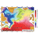
TerrSet 2020 | Stand Alone General License, Download
-
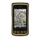
TerraSync Standard Edition
-

TerraFlex Advanced Subscription, 1 Year
-
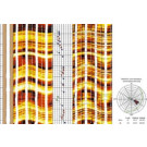
Surfer, Single License
-

Strater v5, Standalone Single User - ESD Download version
-
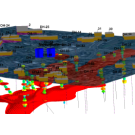
RockWorks, Standard license: Basic Level
-

RockWorks, Single license: Basic Level
-

RockWorks, Advanced license: Basic Level
-

PetroVisual: One Concurrent User, Annual
-

PetraSim TOUGHREACT Interface: Single License
-
PetraSim TOUGH2/T2VOC Interface: Single License
-

PetraSim TMVOC Interface: Single License
-

PetraSim Core Module: Single License
-

MapViewer v8, Standalone Single User - ESD Download version
-

MapInfo Pro Perpetual + MATS – 1 Year
-

MapInfo Pro Advanced, 1 Year Subscription
-

MapInfo Advanced Subscription - 1 Year
-

LogPlot, Single License
-

LogPlot, Network License
-

Grapher v18, Standalone Single User - ESD Download version
-

Golden Software Surfer v24 Concurrent-use annual subscription
-

Golden Software Surfer - Single User, Perpetual license
Regular Price: MYR7,088.00 -

Golden Software Surfer - Single User license, Annual Subscription
-

Global Mapper Standard, Single User Node-Locked
-

Global Mapper Standard, Single User Floating
-

Global Mapper Standard, Network
-

Global Mapper Pro, Single User Node-Locked
-

Global Mapper Pro, Single User Floating
-

Global Mapper Pro, Network
-

Extensis GeoExpress - Unlimited Floating Annual Subscription
-

Didger v5, Standalone Single User - ESD Download version
-
AQTESOLV Standard, Single-User
-

AQTESOLV Pro, Single-User
37 Item(s)
per page
Grid List


My Cart
You have no items in your shopping cart.